We Use CookiesWe use cookies to enhance the security, performance, functionality and for analytical and promotional activities. By continuing to browse this site you are agreeing to our privacy policy

10 Best Chartplotter 2026 in the United States
How do we rank products for you?

Our technology thoroughly searches through the online shopping world, reviewing hundreds of sites. We then process and analyze this information, updating in real-time to bring you the latest top-rated products. This way, you always get the best and most current options available.

headphones-stars

Our Top Picks

#1

Winner

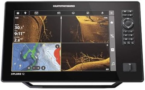
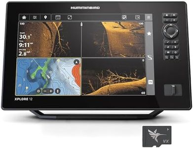
Humminbird XPLORE 12 GPS Fish Finder with Transducer, MEGA Side Imaging+ & HD Touchscreen

Rating
10.0
Chosen by1,317
Screen Size
User Interface
Connectivity

Most important from
93 reviews

Screen Size
The bright, large 12-inch screen remains clear and easy to read even in full sunlight, enhancing on-water visibility.
User Interface
The interface is a huge improvement with easy touchscreen typing and fully customizable screens, making navigation intuitive.
Connectivity
The inclusion of a full NMEA 2000 system enables excellent integration with compatible marine electronics, though older sensors may not be supported.
Chart Compatibility
The built-in Coastal Maps are surprisingly limited in coverage, requiring costly premium chart upgrades for comprehensive nearshore data.

The Humminbird XPLORE 12 GPS Fish Finder delivers a strong package for anglers looking for an advanced chartplotter with premium sonar and navigation features. It offers a large 12-inch screen with a sharp 1280 x 720 resolution, providing clear and detailed visuals that are easy to read on the water. The built-in GPS includes a comprehensive Humminbird Basemap, LakeMaster and CoastMaster VX maps for US and Canada, and compatibility with popular Navionics charts, making it suitable for both freshwater and coastal fishing.

Its standout sonar technology, including MEGA Side Imaging+ and MEGA Down Imaging+, offers wide and deep scanning with excellent fish detection up to 200 feet. The AutoChart Live feature allows users to create real-time maps of underwater terrain and vegetation, enhancing fishing strategies. Connectivity options such as high-speed Ethernet, Bluetooth, and NMEA 2000 support enable integration with other marine electronics and compatible trolling motors, adding to the system's flexibility. The user interface combines a responsive touchscreen with keypad controls for easy operation under various conditions.

The unit is corded and relatively heavy (over 6.5 kg), making it better suited for boats with stable mounting points rather than portable or kayak use. This makes the Humminbird XPLORE 12 an excellent choice for serious anglers seeking a feature-rich fish finder and chartplotter with top-tier sonar and mapping capabilities, while casual users or those requiring a lightweight, fully waterproof unit might prefer other options.

Rating
10.0
Chosen by1,317
Screen Size
User Interface
Connectivity

Most important from
93 reviews

Screen Size
The bright, large 12-inch screen remains clear and easy to read even in full sunlight, enhancing on-water visibility.
User Interface
The interface is a huge improvement with easy touchscreen typing and fully customizable screens, making navigation intuitive.
Connectivity
The inclusion of a full NMEA 2000 system enables excellent integration with compatible marine electronics, though older sensors may not be supported.
Chart Compatibility
The built-in Coastal Maps are surprisingly limited in coverage, requiring costly premium chart upgrades for comprehensive nearshore data.
#2

Humminbird XPLORE 12 GPS Fish Finder, MEGA Side Imaging+ & HD Touchscreen (Control Head Only)

Rating
9.7
Screen Size
GPS Receiver
Chart Compatibility

Most important from
48 reviews

Screen Size
The 12-inch color touchscreen offers excellent visibility and easy navigation on the water.
GPS Receiver
Built-in GPS with comprehensive basemaps covers over 10,000 lakes and coastal waters across the US and Canada.
Chart Compatibility
AutoChart Live enables real-time mapping, perfect for tracking and customizing fishing spots.
Connectivity
Connectivity options like Bluetooth, Ethernet, and NMEA 2000 support seamless integration with other boating devices.

The Humminbird XPLORE 12 is a solid choice for anglers seeking a large, clear display and advanced sonar technology. Its 12-inch color touchscreen coupled with keypad options offers easy navigation and good visibility on the water. The MEGA Side Imaging+ and MEGA Down Imaging+ deliver excellent detail with up to 200 feet range and depth, helping users identify fish and underwater structures effectively.

The built-in GPS is enhanced with detailed basemaps covering over 10,000 lakes and coastal waters in the US and Canada, plus you get LakeMaster and CoastMaster maps for even better navigation. AutoChart Live lets you create real-time maps, which is handy for tracking favorite fishing spots. Connectivity is strong, featuring Bluetooth for wireless anchor control and smartphone alerts, along with Ethernet and NMEA 2000 support for integrating other boating devices.

This model is sold as control head only, so you’ll need to purchase a compatible transducer separately, which adds to the cost and setup time. The Humminbird XPLORE 12 suits anglers who want a feature-rich and versatile fish finder/chartplotter, especially if they value mapping and connectivity but are prepared to invest in additional hardware to complete the system.

Rating
9.7
Screen Size
GPS Receiver
Chart Compatibility

Most important from
48 reviews

Screen Size
The 12-inch color touchscreen offers excellent visibility and easy navigation on the water.
GPS Receiver
Built-in GPS with comprehensive basemaps covers over 10,000 lakes and coastal waters across the US and Canada.
Chart Compatibility
AutoChart Live enables real-time mapping, perfect for tracking and customizing fishing spots.
Connectivity
Connectivity options like Bluetooth, Ethernet, and NMEA 2000 support seamless integration with other boating devices.
#3

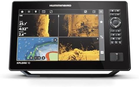
Humminbird XPLORE 10 GPS Fish Finder with Transducer, MEGA Side Imaging+ & HD Touchscreen

Rating
9.1
GPS Receiver
Chart Compatibility
Connectivity

Most important from
93 reviews

GPS Receiver
The depth finder, GPS, and trolling motor control work seamlessly together, making navigation and fishing effortless.
Chart Compatibility
The auto chart feature allows for custom mapping of local lakes, increasing the unit’s adaptability to different waters.
Connectivity
Controlling the Minnkota trolling motor is straightforward and intuitive, adding to the unit’s versatility.
User Interface
Navigating through the device’s functions is user-friendly, supported by ample online resources for learning.

The Humminbird XPLORE 10 is a solid choice for anglers who want a versatile chartplotter and fish finder combined. Its 10.1-inch screen offers a sharp 1280 x 720 resolution, making maps and sonar images clear and easy to read even in bright outdoor conditions. The touchscreen paired with keypad controls gives flexibility in operation, which is helpful if one method feels more comfortable or practical on the water. The built-in GPS is reliable, featuring a detailed basemap with access to over 10,000 lakes and compatibility with popular mapping cards like LakeMaster and Navionics. This means you can count on accurate positioning and detailed chart updates.

The advanced sonar technology, including MEGA Side Imaging+ and MEGA Down Imaging+, provides impressive underwater views with a 200-foot range, helping you spot fish and underwater structures with good detail. Connectivity is well covered with Ethernet, Bluetooth, and NMEA 2000 support, allowing easy integration with other devices like trolling motors or additional sensors. While the device is designed for durability and use on water, it does not specify a particular waterproof rating, so some care around heavy splashes may be advisable. At around 4.75 pounds and a sturdy build, it balances portability with robustness.

The included 3-year warranty adds peace of mind for long-term use. This chartplotter suits casual to serious anglers looking for dependable GPS navigation combined with advanced fish-finding capabilities, although those needing extreme waterproofing or a larger, ultra-high-resolution display might consider other models.

Rating
9.1
GPS Receiver
Chart Compatibility
Connectivity

Most important from
93 reviews

GPS Receiver
The depth finder, GPS, and trolling motor control work seamlessly together, making navigation and fishing effortless.
Chart Compatibility
The auto chart feature allows for custom mapping of local lakes, increasing the unit’s adaptability to different waters.
Connectivity
Controlling the Minnkota trolling motor is straightforward and intuitive, adding to the unit’s versatility.
User Interface
Navigating through the device’s functions is user-friendly, supported by ample online resources for learning.

Buying Guide for the Best Chartplotter

Choosing the right chartplotter for your boating needs can significantly enhance your navigation experience. A chartplotter is an essential tool that helps you plot your course, track your position, and avoid hazards while on the water. To make an informed decision, it's important to understand the key specifications and how they align with your specific needs. Here are the main specs to consider when selecting a chartplotter.
Screen SizeThe screen size of a chartplotter is crucial as it determines how much information you can see at once and how easy it is to read the display. Screen sizes typically range from 5 inches to over 12 inches. Smaller screens (5-7 inches) are more compact and suitable for smaller boats or limited dashboard space. Medium screens (8-10 inches) offer a good balance between visibility and space, making them ideal for mid-sized boats. Larger screens (11 inches and above) provide the best visibility and are perfect for larger vessels or those who need to see detailed charts and multiple data inputs simultaneously. Choose a screen size that fits your boat's space and your need for visibility.
ResolutionResolution refers to the clarity and detail of the display. Higher resolution means sharper and more detailed images, which can be particularly important for reading charts and identifying features. Resolutions can range from 480 x 272 pixels in smaller, basic models to 1280 x 800 pixels or higher in premium models. If you need to see fine details and use the chartplotter in bright sunlight, opt for a higher resolution. For casual use or smaller screens, a lower resolution may suffice.
GPS ReceiverThe GPS receiver in a chartplotter determines how accurately and quickly it can pinpoint your location. A high-quality GPS receiver will provide more accurate positioning and faster updates, which is crucial for safe navigation. Some chartplotters come with built-in GPS, while others may require an external antenna. For most users, a built-in GPS with good accuracy (within a few meters) is sufficient. If you navigate in challenging environments or need the highest precision, consider a chartplotter with an advanced GPS receiver or the option to connect an external antenna.
Chart CompatibilityChart compatibility refers to the types of nautical charts the chartplotter can use. Different chartplotters support different chart formats, such as Navionics, C-MAP, or proprietary charts. It's important to choose a chartplotter that supports the charts you prefer or need for your region. Some chartplotters come with preloaded charts, while others require you to purchase them separately. Ensure the chartplotter you choose is compatible with the charts that cover your boating areas and provide the level of detail you need.
ConnectivityConnectivity options in a chartplotter can include Wi-Fi, Bluetooth, NMEA 2000, and Ethernet. These connections allow the chartplotter to communicate with other devices, such as fish finders, radar, autopilot systems, and smartphones. Wi-Fi and Bluetooth enable wireless updates and data sharing, while NMEA 2000 and Ethernet provide robust connections for integrating with other marine electronics. Consider your current and future needs for connectivity and choose a chartplotter that offers the necessary ports and wireless capabilities.
User InterfaceThe user interface (UI) of a chartplotter affects how easy it is to use. A well-designed UI with intuitive menus, touchscreens, and customizable displays can make navigation simpler and more efficient. Some chartplotters offer touchscreens, while others use buttons or a combination of both. If you prefer a more modern, smartphone-like experience, a touchscreen may be ideal. For rough conditions or when wearing gloves, physical buttons might be more practical. Choose a chartplotter with a UI that you find easy to navigate and operate.
Durability and WaterproofingDurability and waterproofing are important for ensuring your chartplotter can withstand the marine environment. Look for chartplotters with high waterproof ratings (such as IPX7 or IPX8) to ensure they can handle splashes, rain, and even brief submersion. Additionally, consider the build quality and materials used, as these will affect the chartplotter's longevity and resistance to corrosion. If you frequently boat in harsh conditions, prioritize a chartplotter with robust durability and waterproofing features.

FAQ

Most Popular Categories Right Now