10 Best Mapping Drones 2026 in the United States
Related Products
Up to 32% off


Our technology thoroughly searches through the online shopping world, reviewing hundreds of sites. We then process and analyze this information, updating in real-time to bring you the latest top-rated products. This way, you always get the best and most current options available.

Our Top Picks
Winner
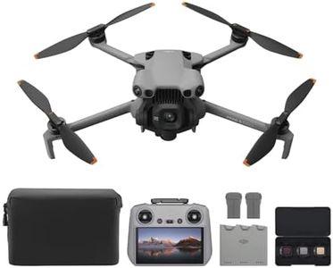
DJI Mini 5 Pro Fly More Combo With DJI RC 2, 1-Inch CMOS
Most important from
623 reviews
The DJI Mini 5 Pro Fly More Combo is a great choice for beginners interested in mapping and aerial photography. It features a high-quality 1-inch CMOS sensor capable of 4K/60fps HDR video, which means you get sharp, colorful footage useful for detailed mapping tasks. Its 50 MP still resolution also supports capturing clear images from the air. The drone’s flight time of up to 36 minutes per battery is solid, and with three batteries included, you can extend your flying sessions significantly. GPS accuracy is supported through advanced sensors and features like ActiveTrack 360°, enabling reliable tracking and positioning for smooth data capture.
One of the standout features is its omnidirectional obstacle sensing, which uses forward-facing LiDAR and vision sensors to detect obstacles in all directions. This improves safety during flights, especially when operating in complex environments. The flexible gimbal with 225° rotation allows for creative and vertical shots, adding versatility to your mapping angles.
The drone is ultra-light and compact, weighing about 250 grams, making it easy to carry but not designed for carrying additional heavy equipment or sensors. Its range, combined with Wi-Fi and RF communications, meets typical recreational and prosumer needs but may be limited compared to specialized long-range mapping drones. The lightweight design might affect performance in very windy conditions, and the DJI Fly app must be manually downloaded since it is not available on Google Play, which could be inconvenient. Additionally, flying at night or in specific areas may require permits, so checking local regulations before use is advised.
Most important from
623 reviews
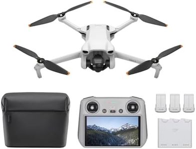
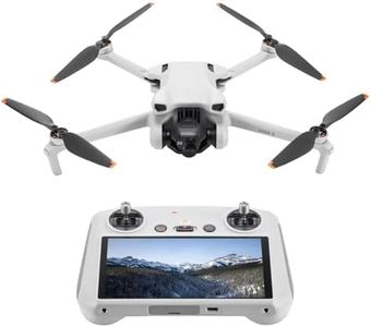
DJI Mini 3 Fly More Combo With DJI RC, 3 Batteries
Most important from
3016 reviews
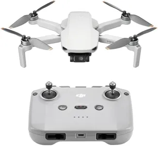
The DJI Mini 3 Fly More Combo is a lightweight drone ideal for beginners and casual users interested in aerial photography or mapping. Its standout feature is the 4K UHD camera with 48MP photos and vertical shooting, allowing you to capture detailed, high-quality images and videos even in challenging light conditions. The 3-axis gimbal ensures smooth footage by stabilizing the camera during flight. Flight time is impressive for its size, with up to 38 minutes per battery and three batteries included for a total of 114 minutes, which is excellent for longer sessions without frequent recharging.
The drone offers strong GPS features like precise hovering and Return to Home, enhancing safety and ease of control — helpful if you are new to flying. With up to 10 kilometers of HD video transmission range, you can explore vast outdoor areas while maintaining a clear video feed. However, this model is very lightweight and doesn’t support carrying additional payloads, so it's not suited for carrying extra sensors or equipment needed in professional mapping tasks. Obstacle avoidance is not explicitly mentioned, which means you need to be cautious when flying near trees or buildings. While it resists moderate winds, very windy conditions might affect stability.
This drone doesn’t require FAA registration for recreational use due to its weight, making it a hassle-free choice for hobbyists. The DJI Mini 3 is a solid pick if you're looking for a portable, easy-to-fly drone with excellent camera quality and decent flight time, but it may fall short if you need advanced obstacle avoidance or payload capabilities for professional mapping projects.
Most important from
3016 reviews
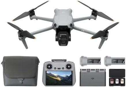
DJI Air 3S Fly More Combo (RC 2 Screen Remote Controller), 4K Drone
Most important from
1214 reviews
The DJI Air 3S Fly More Combo is a strong choice for those interested in mapping drones, especially if you value high-quality imaging and reliable flight performance. Its 1-inch CMOS camera produces sharp 48MP photos and smooth 4K/60fps HDR video, excellent for capturing detailed landscape visuals important in mapping tasks. The drone’s camera also shines in low-light conditions, which can be useful for early morning or evening flights.
Flight time is impressive, with up to 45 minutes per battery and three included batteries, making extended missions more manageable without frequent interruptions to recharge. The drone’s range of 20km allows for wide-area coverage, and its upgraded GPS and smart return-to-home features enhance flight safety and reliability, even in areas with weaker GPS signals. On top of that, the omnidirectional obstacle avoidance, including a forward-facing LiDAR sensor, helps prevent crashes by detecting obstacles from multiple directions, which is a valuable safety feature during complex mapping flights.
The included remote with a built-in screen adds convenience, though the drone’s weight of 724 grams is on the heavier side, which may affect portability for some users. The DJI Air 3S combines advanced camera capabilities, solid flight time, and smart navigation features, making it well-suited for adults and hobbyists who need a dependable drone for detailed mapping and scenic aerial footage.
Most important from
1214 reviews
Buying Guide for the Best Mapping Drones
When choosing a mapping drone, it's important to consider several key specifications to ensure you select the best fit for your needs. Mapping drones are used for a variety of applications, including surveying, agriculture, construction, and environmental monitoring. The right drone for you will depend on the specific requirements of your projects, such as the area you need to cover, the level of detail required, and the conditions in which you'll be operating. Here are some key specs to consider and how to navigate them.FAQ
Most Popular Categories Right Now


